
UIS GEOMODELLING AND VISUALISATION
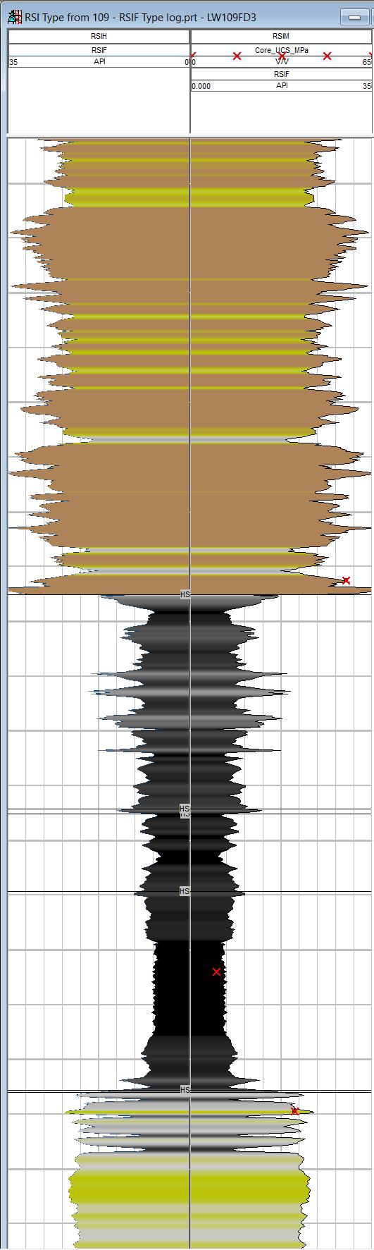
Our Yabby GeoSensing System creates and records real-time coal seam properties and spatial data in an integrated 3D model with high accuracy and reliability.
The Yabby is a “mobile rock testing lab” that measures properties continuously whilst drilling formation in-situ. No need to take the rock to the lab. Yabby precisely defines subsurface properties such as coal strength, gas and water rates within the seam, and the relationship of the borehole path to the roof and floor. Seam structure, faults, dykes and rolls can be observed and mapped with precision.
This patented system elevates the UIS rig from a gas drainage tool to the essential geological exploration information provider for high-production longwall mining systems. It is a key element in the path to longwall automation. Make geological surprises a thing of the past. Our service integrates all geological data, new and old, into a roadmap ready for autonomous mining machine steering. Our patented drill monitoring system and visualisation techniques capture the right data, provide the appropriate communication tools, and deliver information that can be relied upon by production planners.